02
Service 02
RTK/PPK-enabled UAV operations give you orthomosaics, DSMs/DTMs, contours, and 3D meshes with rapid turnaround. Ideal for construction progress, earthworks volumes, quarries, and environmental monitoring in line with Saudi mega-project delivery expectations.
Ground control, flight planning, and rigorous QA produce geospatial products at engineering tolerances — from GSD-driven site mapping to corridor updates for linear infrastructure.
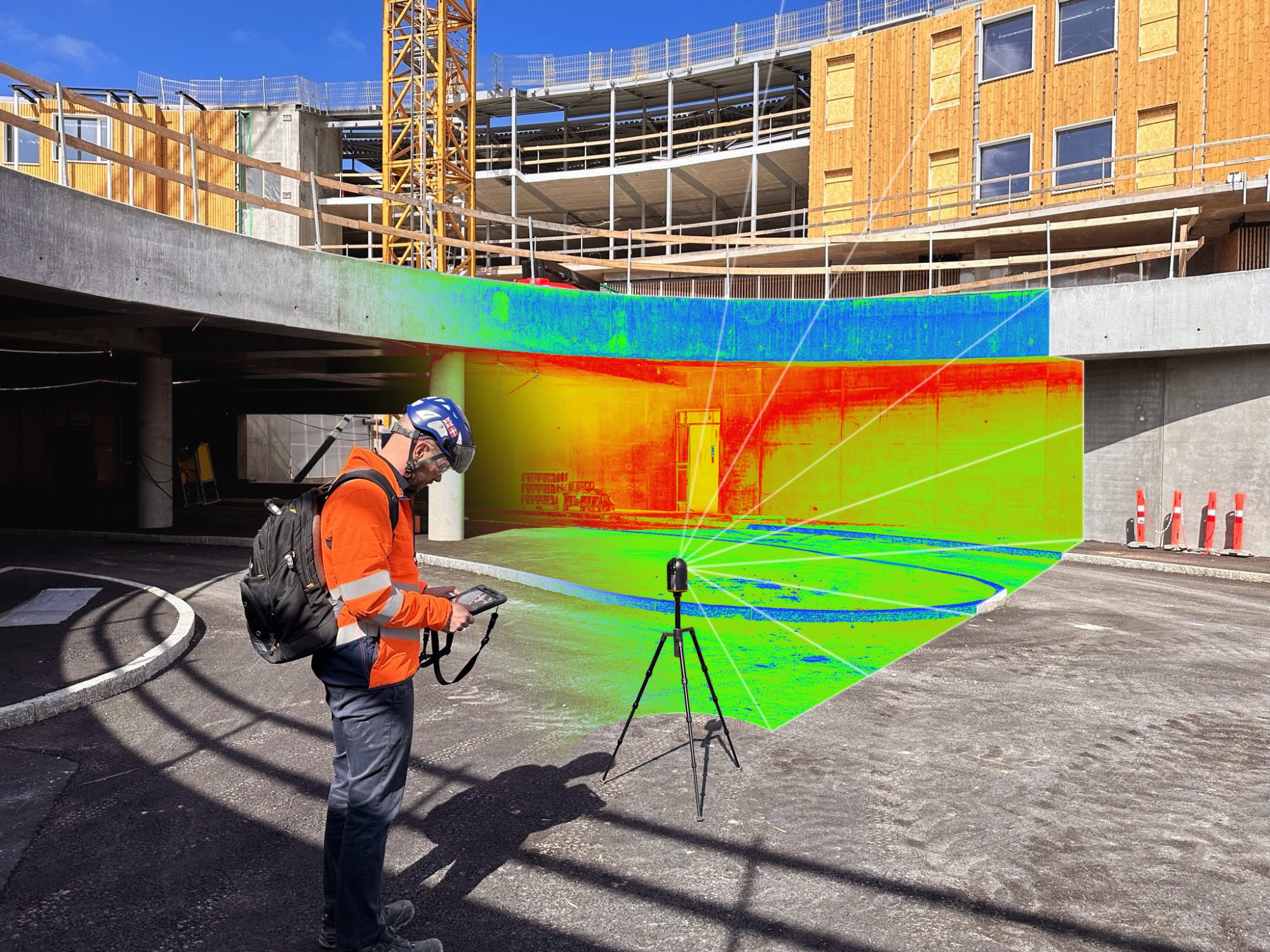
We translate imagery and point clouds into CAD/GIS deliverables, progress reports, and volumetrics so project managers and designers stay aligned on true ground conditions.