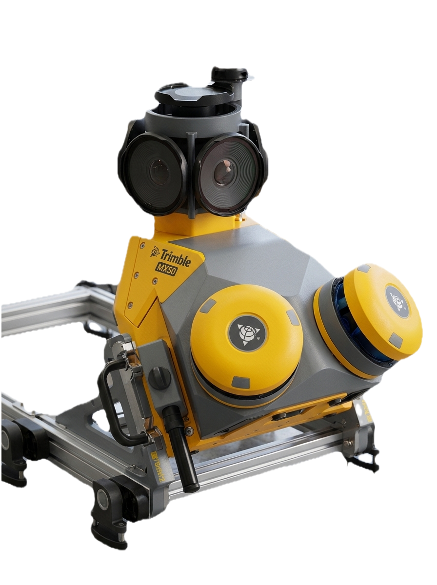
Mobile Mapping MMS
MMS is a vehicle mounted mapping systems for large scale mapping projects. allows us to rapidly collect accurate geospatial data while in motion....
Read More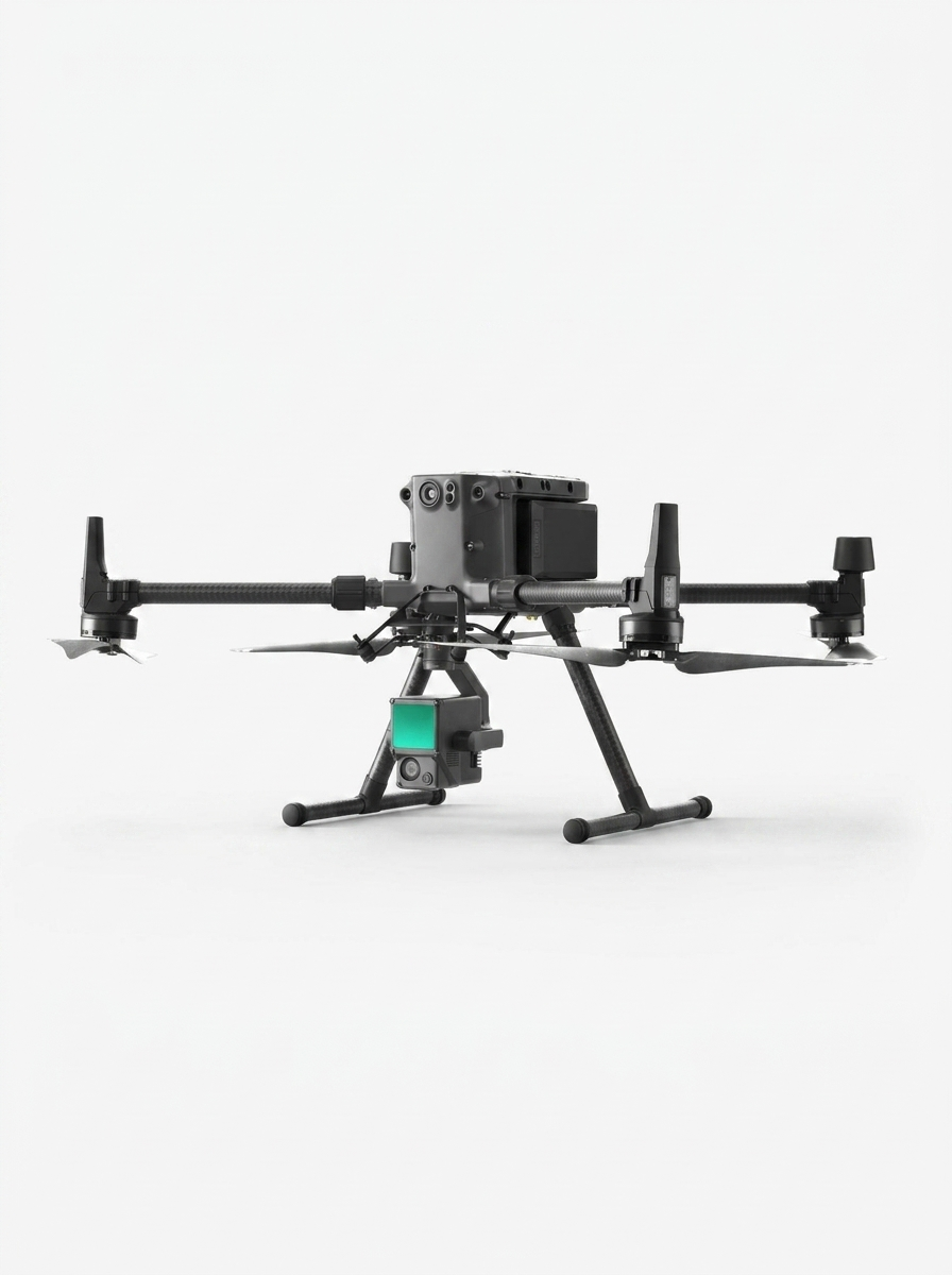
Drone Surveying
Our drone fleet captures high resolution aerial imagery and topographic data quickly and efficiently, especially in hard to reach or expansive areas.....
Read More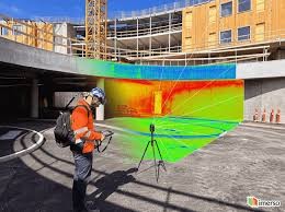
3D Laser Scanning
Using terrestrial laser scanners, we capture millions of data points per second to create highly detailed and accurate 3D models of existing conditions, both indoors and outdoors...
Read More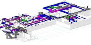
BIM(Building Information Modeling)
Our BIM services integrate spatial data into intelligent 3D models for planning, design, construction, and maintenance. We support full lifecycle project management and facility....
Read More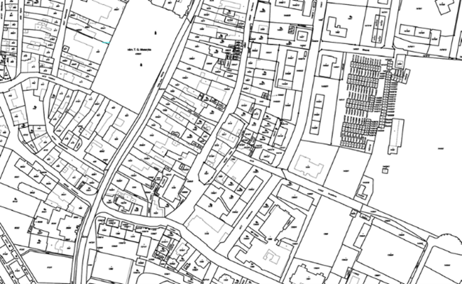
Land Surveying
From cadastral to topographic surveys, our surveyors use advanced equipment like GPS, Total Stations, Digital Levels, RTK, PPK, Static & VRS methods to provide highly accurate .....
Read More
Smart Cities - Digital Twins
We enable smart urban planning and asset management by creating digital twins real-time, interactive digital replicas of physical systems and spaces....
Read More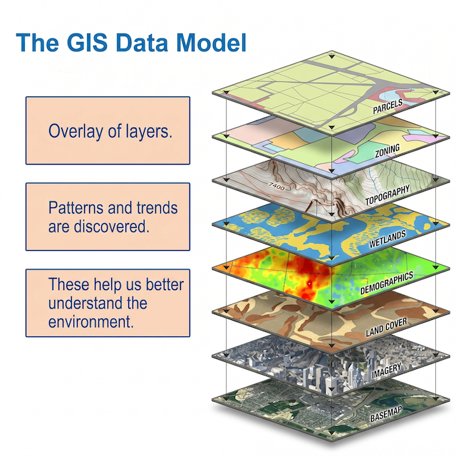
GIS(Geographic Information System)
We use GIS to manage, analyze, and visualize spatial data for better decision-making in urban development, transportation, and resource management....
Read More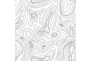
Topo Maps
Our topographic and digital mapping services provide clear, detailed visuals of natural and man-made features to support design, construction, and planning activities.....
Read More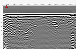
Utility Detection by (GPR)
Using GPR, we detect and map underground utilities like pipelines, cables, and voids without excavation. This ensures safety and accuracy in construction and planning.....
Read MoreService lines & deliverables
The eight core service areas from our official company profile, with typical deliverables and industries served. This complements the service cards above.
MMS (Mobile Mapping System)
Vehicle-mounted mapping using cameras, LiDAR, and GNSS for high-productivity corridor and network surveys.
Deliverables
- •3D Point Clouds
- •Panoramic 360° Images
- •Street View Maps
- •2D/3D CAD Drawings
- •GIS-Compatible Data
- •Pavement assessment
- •Highway maintenance
- •Road asset management
- •Accurate ground models
- •Engineering profiles and cross-sections
- •Road surface information
- •City assets
Industries
- •Urban Planning Authorities & Utility Companies
- •Transport & Infrastructure
- •Smart City Projects
- •Ministries & Municipalities
Drone Surveying
RTK/PPK-enabled drones for aerial mapping and inspection.
Deliverables
- •3D colorized Point Clouds
- •Orthomosaic photos (2cm accuracy)
- •DSM
- •DTM
- •3D textured mesh
- •Contour & Elevation Maps
- •2D/3D CAD Drawings
- •Progress Videos & Monitoring Reports
- •Volume Calculations
- •Thermal & Multispectral Imaging
Industries
- •Construction & Real Estate
- •Progress tracking
- •Environmental Management
- •Mining & Quarries
- •Agriculture & Land Use
- •Oil & Gas
- •Municipalities
3D Laser Scanning
Millimeter-accurate as-built documentation using terrestrial laser scanners.
Deliverables
- •High-Resolution 3D Point Clouds
- •Panoramic Images
- •As-Built 2D & 3D Drawings
- •Interactive VR Walkthroughs
- •Volume Analysis
- •Deformation Analysis Reports
- •Wall verticality report
- •Tank Calibration
- •Floor flatness & levelness check
Industries
- •Facility Management
- •Architects & Engineers
- •Industrial Plants
- •Historical Preservation
Ground Penetrating Radar (GPR)
Non-destructive underground utility detection.
Deliverables
- •Location & Depth of Utilities
- •2D Utility Maps
- •3D Utility Models
- •Cross-Sectional Views
- •Material Identification
- •Risk Assessment for Excavation
- •Voids and cavities
- •Material inconsistencies
- •Structural foundations
- •Underground storage tanks
Industries
- •Construction & Excavation
- •Utilities & Energy
- •Oil & Gas
- •Construction Firms
- •Municipalities
BIM (Building Information Modeling)
Integrates spatial data into intelligent 3D models. GIS + BIM for digital twins. Benefits: reduces risks, reduces rework costs, improves collaboration, improves decision-making.
Deliverables
- •IFC Models (Various LODs)
- •Construction Coordination Drawings
- •BIM Integration with GIS & Scan Data
- •GeoBIM
Industries
- •Construction & Infrastructure
- •Facility Management
- •Urban Development
GIS
Manage, analyze, and visualize spatial data. Cloud-based SaaS platforms, geospatial analytics, IoT data streams.
Deliverables
- •Custom Digital Maps
- •Web-Based GIS Portals & Dashboard
- •Network & Spatial Analysis
- •Data Integration & Management
- •Multi-Layer Map Visualizations
- •GeoAI output
- •Digitizing Vector Layers from satellite imagery
- •Database Creation & management
Industries
- •Environmental & Agriculture
- •Utilities & Infrastructure
- •Government & Planning
Land Surveying
All scales from individual plots to large multi-acre developments. Tools: GNSS, Total Stations, 3D Laser Scanning, LiDAR, UAVs/Drones.
Deliverables
- •Boundary & Property Surveys
- •As Built Surveys
- •Cadastral Surveying
- •Site Layout Plans
- •Building floor plans
- •Volume Calculations
- •Topographic Surveying
- •Physical Demarcation
- •Title Deeds Studies
- •Land-cover and Land-use Change
- •Control Points GCPs
Industries
- •Real Estate Development
- •Legal & Regulatory
- •Infrastructure Planning
- •Municipalities
- •Contractors
Topo Maps & Digital Mapping
High-precision topographic and digital mapping. Data collected via drones, LiDAR, GNSS, 3D laser scanning.
Deliverables
- •Contour maps
- •Elevation Models
- •Elevation Spots
- •Land Use Maps
- •Hydrology & Drainage Maps
- •DTM/DSM/DEM
- •Road assets survey
Industries
- •Engineering Firms
- •Land Development Agencies
- •Agriculture & Forestry
- •Government & Planning Departments