Course Schedule
Day1
GPS Fundamentals & Positioning Principles- GPS segments: space, control, user
- GNSS constellations: GPS, GLONASS, Galileo, BeiDou
- Absolute vs. relative positioning
- Coordinate systems
Day2
Control Network Design & Surveying Techniques- Purpose and hierarchy of control networks (primary, secondary, tertiary)
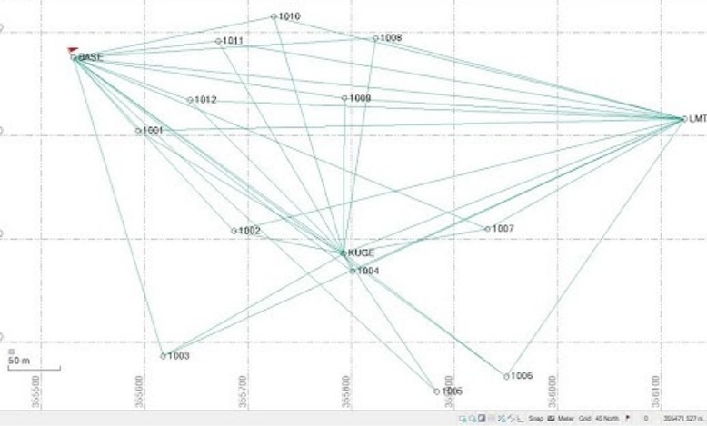
- Network geometry: how baseline length and redundancy impact quality
- Static GPS vs. Kinematic vs. RTK surveying – when to use each
- Design a small control network for a 5 km² infrastructure site. Choose between static (higher accuracy) and RTK (speed) based on project constraints.
- Sketch a control network for a road alignment project. Select observation duration and session repeat times.
Day3
Error Sources & Quality Control (QC)- Satellite errors (ephemeris, clock drift)
- Atmospheric errors (ionosphere, troposphere) – how to model or mitigate
- Multipath and receiver noise
- QC procedures: baseline repeatability, loop closure, RMS checks
- Run basic QC on a raw GPS dataset. Identify a multipath-affected baseline and decide whether to re-observe or apply software filtering.
Day4
Geodetic Systems, Transformations & Multi-Sensor Integration- Ellipsoid vs. geoid – why vertical datum matters
- Common geodetic systems (WGS84, GRS80, local Saudi datums if applicable)
- Coordinate transformations: 3-parameter vs. 7-parameter (Helmert)
- Integrating GPS with total stations, LiDAR, and drones
- Convert a set of WGS84 coordinates to a local engineering grid. Understand why GPS heights need geoid correction for civil works.
- Apply a 7-parameter transformation using simplified software or spreadsheet. Compare transformed coordinates to known control points.
Day5
Field Workflow, Processing & Case Studies- Field setup: antenna height measurement, occupation times, logging parameters
- Post-processing workflow using common software (e.g., Trimble Business Center)
- Resolving ambiguity fixing failures and cycle slips
- Real-world case studies: control network failures and successes
- Execute a complete mini workflow: field collection → download → post-process → QC → transformation → deliverable.
- Given a small raw GPS dataset (simulated), produce a final control point coordinate with uncertainty estimate and a one-page QC report.
What You Will Learn
- GPS Fundamentals & Positioning Principles Core Topics (Half-day theory + half-day exercises): • GPS segments: space, control, user • GNSS constellations: GPS, GLONASS, Galileo, BeiDou • Absolute vs. relative positioning • Coordinate systems
- Design and evaluate geodetic control networks
- Perform RTK, static, and kinematic GPS surveys
- Apply GPS quality control and error mitigation techniques
- Transform coordinates between geodetic systems
- Integrate GPS data with LiDAR, drones, and total stations
- Process and validate GPS survey datasets professionally
- Generate final control point reports with QC analysis